TYPE:
SENSOR
LAYER:
DS_PHR1A_201805111646190_FR1_PX_W091N29_1012_00275
FORMAT:
DIMAP
RASTER:
image/jp2
General Information
Map Name
Geometric Processing Level
Radiometric Processing Level
BASIC
Image dimensions
Number of columns
1774
Number of rows
1436
Number of spectral bands
4
Dataset framing
Vertice
Longitude (DEG)
Latitude (DEG)
Row
Col
#1
-90.27848340493983
29.46855279206092
1
#2
-90.23904855697654
29.46757424523479
#3
-90.23909872806853
29.4375746900455
#4
-90.27850221876422
29.43851429512901
Dataset sources
PHR
Coordinate Reference System
Projected Coordinate System
Geocoding tables identification
EPSG(6.3)
Production
Production Date
2018-06-14T13:58:54.133
Job identification
3064421101-002
Dataset Producer Identification
AIRBUS DS GEO
Producer link
http://www.geo-airbusds.com
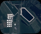
Quicklook
Copyright