TYPE:
SENSOR
LAYER:
DS_PHR1A_201805111646190_FR1_PX_W091N29_1012_00275
FORMAT:
DIMAP
RASTER:
image/jp2
General Information
Map Name
Geometric Processing Level
Radiometric Processing Level
BASIC
Image dimensions
Number of columns
7091
Number of rows
5744
Number of spectral bands
1
Dataset framing
Vertice
Longitude (DEG)
Latitude (DEG)
Row
Col
#1
-90.27848763500313
29.4685560185672
#2
-90.23906392375217
29.46757783823053
#3
-90.23911415125787
29.43756278415526
#4
-90.27850647895586
29.43850188874966
Dataset sources
PHR
Coordinate Reference System
Projected Coordinate System
Geocoding tables identification
EPSG(6.3)
Production
Production Date
2018-06-14T13:59:15.524
Job identification
3064421101-001
Dataset Producer Identification
AIRBUS DS GEO
Producer link
http://www.geo-airbusds.com
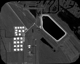
Quicklook
Copyright