TYPE:
SENSOR
LAYER:
DS_PHR1A_201805111646119_FR1_PX_W091N29_0912_00286
FORMAT:
DIMAP
RASTER:
image/jp2
General Information
Map Name
Geometric Processing Level
Radiometric Processing Level
BASIC
Image dimensions
Number of columns
1810
Number of rows
1497
Number of spectral bands
4
Dataset framing
Vertice
Longitude (DEG)
Latitude (DEG)
Row
Col
#1
-90.27848712785583
29.4683097152164
1
#2
-90.23907922674996
29.46732494350018
#3
-90.23910964090609
29.43755455677562
#4
-90.27848729044541
29.43850200840384
Dataset sources
PHR
Coordinate Reference System
Projected Coordinate System
Geocoding tables identification
EPSG(6.3)
Production
Production Date
2018-06-14T14:09:13.388
Job identification
3064422101-002
Dataset Producer Identification
AIRBUS DS GEO
Producer link
http://www.geo-airbusds.com
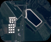
Quicklook
Copyright