TYPE:
SENSOR
LAYER:
DS_PHR1A_201805111646119_FR1_PX_W091N29_0912_00286
FORMAT:
DIMAP
RASTER:
image/jp2
General Information
Map Name
Geometric Processing Level
Radiometric Processing Level
BASIC
Image dimensions
Number of columns
7238
Number of rows
5988
Number of spectral bands
1
Dataset framing
Vertice
Longitude (DEG)
Latitude (DEG)
Row
Col
#1
-90.27849909447747
29.46832856572986
#2
-90.23908567053809
29.46734355907384
#3
-90.23911597120774
29.43755802280833
#4
-90.27849909812096
29.43850559748736
Dataset sources
PHR
Coordinate Reference System
Projected Coordinate System
Geocoding tables identification
EPSG(6.3)
Production
Production Date
2018-06-14T13:59:29.940
Job identification
3064422101-001
Dataset Producer Identification
AIRBUS DS GEO
Producer link
http://www.geo-airbusds.com
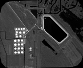
Quicklook
Copyright