TYPE:
ORTHO
LAYER:
DS_PHR1B_201603061754255_FR1_PX_W105N40_0215_00321
FORMAT:
DIMAP
RASTER:
image/jp2
General Information
Map Name
Geometric Processing Level
Radiometric Processing Level
BASIC
Image dimensions
Number of columns
2600
Number of rows
1848
Number of spectral bands
4
Dataset framing
Vertice
Longitude (DEG)
Latitude (DEG)
Row
Col
#1
-104.8962462277822
40.48052335505272
1
#2
-104.8349191436347
40.48045203382507
#3
-104.835000594574
40.44717263547523
#4
-104.8962974200928
40.44724387339936
Dataset sources
PHR
Coordinate Reference System
Projected Coordinate System
Geocoding tables identification
EPSG(6.3)
Projected Coordinate System name
32613
Projected Coordinate System code
urn:ogc:def:crs:EPSG::32613
Geoposition
Upper - Left Map X Coordinate
508792
Upper - Left Map Y Coordinate
4481100
Image sampling
2 x 2
Production
Production Date
2016-05-23T15:05:20.743
Job identification
1788013101-002
Dataset Producer Identification
AIRBUS DS GEO
Producer link
http://www.geo-airbusds.com
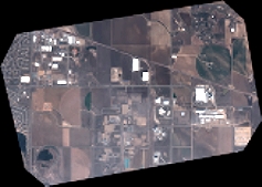
Quicklook
Copyright