TYPE:
ORTHO
LAYER:
DS_PHR1B_201603061754255_FR1_PX_W105N40_0215_00321
FORMAT:
DIMAP
RASTER:
image/jp2
General Information
Map Name
Geometric Processing Level
Radiometric Processing Level
BASIC
Image dimensions
Number of columns
10399
Number of rows
7387
Number of spectral bands
1
Dataset framing
Vertice
Longitude (DEG)
Latitude (DEG)
Row
Col
#1
-104.8962639181894
40.48052787545658
#2
-104.8349250316937
40.48045654675799
#3
-104.8350064577105
40.4471861574916
#4
-104.8963150879354
40.44725740290048
Dataset sources
PHR
Coordinate Reference System
Projected Coordinate System
Geocoding tables identification
EPSG(6.3)
Projected Coordinate System name
32613
Projected Coordinate System code
urn:ogc:def:crs:EPSG::32613
Geoposition
Upper - Left Map X Coordinate
508792
Upper - Left Map Y Coordinate
4481099
Image sampling
0.5 x 0.5
Production
Production Date
2016-05-23T15:04:58.149
Job identification
1788013101-001
Dataset Producer Identification
AIRBUS DS GEO
Producer link
http://www.geo-airbusds.com
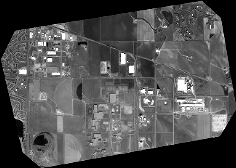
Quicklook
Copyright