TYPE:
ORTHO
LAYER:
DS_PHR1A_201604141754450_FR1_PX_W105N40_0610_00392
FORMAT:
DIMAP
RASTER:
image/jp2
General Information
Map Name
Geometric Processing Level
Radiometric Processing Level
BASIC
Image dimensions
Number of columns
13524
Number of rows
8538
Number of spectral bands
1
Dataset framing
Vertice
Longitude (DEG)
Latitude (DEG)
Row
Col
#1
-104.5674570190567
40.39807977134684
#2
-104.4877834689081
40.39775428780944
#3
-104.4880746093172
40.35930000562099
#4
-104.5677028773143
40.35962504970183
Dataset sources
PHR
Coordinate Reference System
Projected Coordinate System
Geocoding tables identification
EPSG(6.3)
Projected Coordinate System name
32613
Projected Coordinate System code
urn:ogc:def:crs:EPSG::32613
Geoposition
Upper - Left Map X Coordinate
536706
Upper - Left Map Y Coordinate
4472032
Image sampling
0.5 x 0.5
Production
Production Date
2016-05-23T14:58:26.135
Job identification
1788027101-001
Dataset Producer Identification
AIRBUS DS GEO
Producer link
http://www.geo-airbusds.com
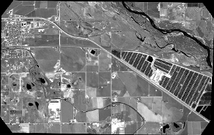
Quicklook
Copyright